Want to do more hiking near Santiago? There are many options around the big city. Cerro Papagayo is one of them, tucked away in the mountains of Pirque and accessible via public transport. With an elevation of 2,324 meters (7,624 feet) and a very rocky summit, it’s a great mountain for beginner mountain climbers.
–
Tucked away in the mountains of Pirque, we parked in what felt like the most random spot on earth. This area is all private property, so you need to pass through a gate and then do a 4 kilometer walk on a dusty dirt road before beginning the climb.
In the morning this is a nice, refreshing, flat walk, passing a couple of houses, a bee farm, and strolling through the peaceful scenery. However, on the way back to the car, when your legs are tired and you’ve been walking all day, it can be slight torture and feels more like 40km.
Downloading the route to our GPS is always a best practice and it will also help you in this beginning part. The part where you veer to the right and head to the base of the mountain is a bit hidden.
Cerro Papagayo is fun because it offers different terrain, from easy hiking to a little rock scrambling.
Cerro Papagaya in Stats
Altitude: 2,324 meters; 7,624feet
Elevation gain: 1,688 meters; 5,538 feet
Distance: 20.8 km; 12 miles
Time: 8-10 hours round trip
Difficulty: the last 500m is rocky and requires scrambling


Hiking near Santiago – Cerro Papagayo
The route
The first part consists of meandering through a thick forest. Between the incline, the bending over to an almost 90 degree angle to maneuver through brush or branches, and the weight of the backpack, it was a definite balance test! More than a few times I was stopped in my tracks from a string on the backpack.
I love these forest parts because they smell and look just like Wisconsin and it brings me back to the days when I would wander through the trees with my grandpa, parents, aunts and uncles, and cousins. It feels so familiar, like home.
Breaking out of the vegetation, we got to an open space to sit down and stretch. In the next part we horizontally crossed from one side of the mountain to the other, something that doesn’t look so complicated but in reality, provides its challenge. Part comes from the slipperiness of crossing the mountain without a worn path and the other part is just the tiring aspect from the length and incline.
We had a perfect day that wasn’t too sunny and the clouds kept the air nice and brisk. Once I got to the end of this section, we sat down and waited for the rest of the group to get back together.
The bottom half is very green with a lot of vegetation and bushes.
There was about 500 vertical meters left and we made bets for how long it would take. Being a bunch of beginner mountaineers, most of us guessed something around 30-40 minutes. Little did we know the surprise that last little climb had in store for us!!


Like a lot of hiking in the Central Andes
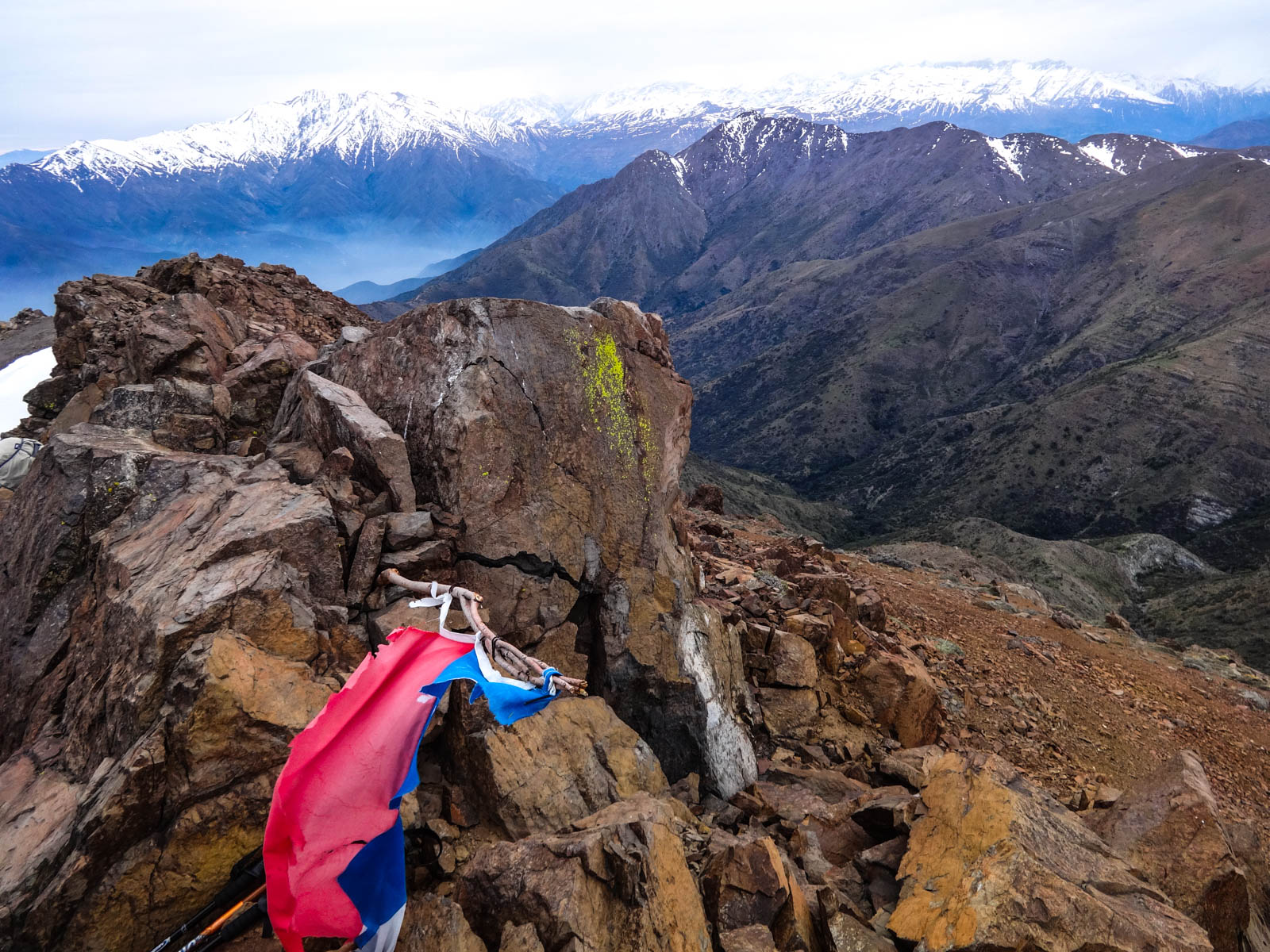
The push to the summit is more like scambling over a rocky slope!
We were on the crest of the mountain, pure rocks and super steep. It was impossible to just “walk” – every step on the dusty, rocky ground induced a waterfall of rocks down the mountain. I had to attach my walking poles to my backpack and use my hands to help maintain balance. Grasping from one rock to another, carefully testing the rocks under my feet, and using my arms to pull me up to the next step.
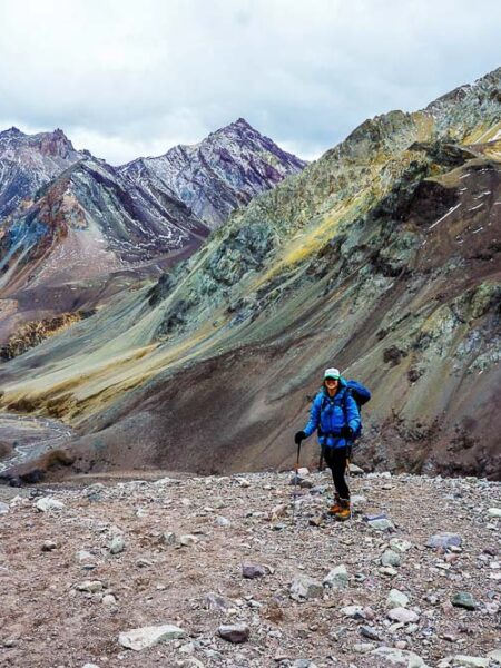
If you look carefully on these pictures… you’ll see tiny people up at the top. It was a loooong way up. This was my first time really with this kind of terrain and I admit I was a bit scared at first. I took a moment to think rationally and get into the proper mindset, looking logically at the route ahead and plotting each movement.
At first it is a little scary because the rocks slide with each step, but you just need to be careful and thoughtful
In the end, it took 1.5-2 hours for the whole group to do that last 500 meters! It was such a relief, and little pat on the back, to get to the summit. Every new experience builds familiarity with my own body and confidence with my movements, which results in better and safer climbing. Advancement, woo hoo!!
Up at the top it was very windy, but we found a little nook to sit down, relax, and have our lunch. It was pretty cold but we sat there about 1/2 hour, enjoying the view, the company, and the work we just accomplished.
Heading down that rocky part had its tricks, a combination of letting myself controllably slide between safe points as well as firmly grabbing the rockbed and lowering by body from one point to another. We ran into a common plant that we see on many of the mountains, but this one had a beautiful surprise, an incredible set of blue flowers! I’m not sure if this was a late bloomer or an early bloomer but, boy, was it a treat.
By the time we got to the forest it was almost dark. The route had never had much of a real path and in the thick woods, with the addition of the darkness, it was difficult to find which was the best way to get back to where we started. The GPS helped but we were zig-zagging our way through, trying to see what looked familiar.
We probably spent an extra hour here but finally found the dirt road. We were so happy, as we had been out 9ish hours at this point and were simply tired. I think my feet felt every heavy step of that 40km, errr, mmm, I mean 4km, back to the car.
I got home and, although I had all the good intentions to meet up with some friends and enjoy a couple of beers… after a hot shower, the draw to my bed won.
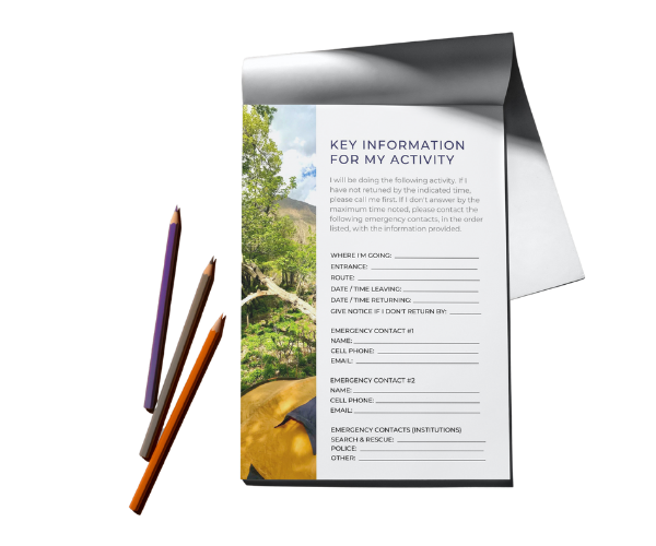
Free Tool: Give Notice Before An Outdoor Activity
Before going to the mountain, or doing any outdoor activity, it is important to give notice. This ensures that you can effectively and efficiently be found in case of an accident or emergency.
This tool lays out what critical information needs to be included and has a PDF you can easily fill out and send to your emergency contacts.

When can you hike Cerro Papagayo?
This is a great Santiago trekking option because you can climb it all year round! However, keep in mind that there’s no water on this mountain and that once you are out of the forest, there is little to no shade. That said, summer months can be very, very hot and appropriate clothing, sunscreen and water is a must. A helmet is always recommended due to the potential of falling rocks.
During winter, the top part will be covered in snow and crampons/ice axe would be important depending on snow and ice conditions.
How do you get to Cerro Papagayo?
From Santiago you head Southeast towards the town of Pirque. You’ll go in the direction of the Puente Alto neighborhood and take the street Concha y Toro, until you get to Ramón Subercaseaux where you’ll turn right (East). Keep going until you get to Santa Rita, turn right (South) and continue for about 5 kilometers, where you’ll turn right (South) on Alicia Valdés de Balmaceda. You’ll soon enter onto private property and will need to park.
If you’re on public transportation, take the Santiago metro until the Bellavista de La Florida station and then take the metrobus MB-80.
Now get out of Santiago and go hiking!!
Related Articles

I'M TALKIN' TO YOU
Purpose-driven people who feel compelled to make life meaningful for yourself and others.
Outdoor-inspired people whose best self comes alive when experiencing beautiful places and pushing your limits in the open air.


