How long does it take to climb Aconcagua? It depends if you take the polish route, the 360 or the Normal Route. This article shares an itinerary for climbing Aconcagua via the Normal Route and includes GPS map links, distances between camps, and other key information.
This itinerary considers hiring mule service to Base Camp (Plaza de Mulas) and then carrying all weight from that point on. The use of porters could cut a day or so off this schedule as you would not need to porter your own equipment. See the article at the end to evaluate available services, such as the use of guides, mules, porters and meals, versus climbing Aconcagua without a guide or other services.
It’s time to plan your climb!
—
Preparing to climb Mount Aconcagua
While preparing my body to climb Aconcagua I switched up my gym routine to include more HIIT workouts (high interval intensity training), core exercises, and strength training. We did regular weekend climbs and began to include higher altitude mountains like El Plomo in the last two months, for altitude training.
This planning and preparation stage for Aconcagua was an educational experience. It required much more than I have had to do for mountains before, considering it was my first of the country climb, it required climbing permits, has more extreme altitude and temperatures, etc.
I learned a lot in terms of expedition planning, risk management, preparing solutions, and defining minute details, all of which help ensure a safe and successful climb. The last thing I wanted was to be up towards the summit and have to come down because I didn’t pack the right equipment and was too cold, or because we weren’t strong enough due to packing inadequate food, or because one of us has a minor problem and our first aid kit wasn’t sufficient.
That said, after successfully climbing and summitting the magestic Mount Aconcagua, I’m excited to share my learnings with you!
”Aconcagua is a magical mountain surrounded by magical mountains. You're most likely not going to repeat this expedition, so make the most of it. Take a few extra days to get to know every corner she has to offer.
Chelsey Berg
Aconcagua Normal Route
Note: In addition to what/if any services you use, how long it takes to climb Aconcagua depends heavily on weather, which changes daily. Sometimes you have to cut out a “luxury” (ie: Bonete / portering equipment) because you’ve got to hurry up the summit attempt. On the other hand, sometimes you’ve got more rest days than planned because the weather doesn’t let you advance faster. Patience!!
Winds around 20-40kph / 10-25mph, cold around -30C/-22F and instananeously changing climates (mmm, we had had white out snow and 20% visibility after 3pm for 5 days in a row) …. this is all very much a part of the challenge Mother Nature throws at you while climbing Mount Aconcagua.


Day 1 – Santiago to Mendoza
Driving from Santiago
Flying to Mendoza from somewhere else in this world
Woo hoo, we’re ready to climb Aconcagua!! Permits ready.
From Santiago, it’s about 6/7 hours to Mendoza depending on the border crossing. This day can be a long, drawn out day so it is highly recomendable to get to Mendoza early and have all day to resolve problems. We got in around 12:30pm and trapsed all over Mendoza in 35C/100F weather, with my flip flops almost giving me blisters and complicating my climb before I even got to the mountain!
First of all, getting the permits in Mendoza can be quite the ordeal. And, there’s a lot to consider regarding guides, mules, other possible services, or going it alone. Check out the links at the bottom of this article for more details, so you can enjoy Mendoza before embarking to the cold and the inhospitable, but marvelous, Mount Aconcagua.
Day 2 – Mendoza to Confluencia
Climb: 2900m – 3400m / 9500ft – 11150ft
Distance: 5.24km / 3.25miles – link to wikiloc route
The route to Aconcagua starts and ends in a colorful valley.
From Mendoza, you head about 2.5 hours towards the Argentina/Chile border, where you first hit Penitentes, the little town that thrives on the mountains. Basically, it’s one road with some motels, hotels, restaurants and other small businesses. The day before in Mendoza, you will have organized exactly where to drop off your equipment for the mules, which will be at one of these little places. So, you get to Penitentes, ideally nice and early, and drop off your equipment. Again, read my article on the mules to get a better idea of how this works.
You’ll then head about 10 more minutes to the Parque Provincial Aconcagua – Horcones, where you stop by the park entrance, show your permits, receive your garbage and poop bags (yes! cuz good mountaineers leave NOTHING on the mountain!) and then you’re ready to go.
The approach to base camp plaza de mulas from Horcones is a very long 25km / 15 miles, so normally people divide it into two stretches and set up camp along the way at Confluencia. This also helps with acclimatizing.
Day 3 – Confluencia to Plaza Francia and back
Climb: 3400m – 4100m / 11150ft – 13450ft
Distance: 18.3km / 11.4 miles – link to wikiloc route
Our 2nd day in Confluencia we will climb to Plaza Francia which has an amazing view of the Southern Face of Aconcagua. This is the most vertical wall of the mountain, with 3000m /10,000ft of vertical distance!
Wow. I highly reccomend stopping at Confluencia so that you can come here. It is a truly spectacular view, not to mention it keeps preparing your body well.
Day 4 – Confluencia to Base Camp, Plaza de Mulas
Climb: 3400m – 4400m / 11150ft – 14400ft
Distance: 20km / 12.4miles – link to wikiloc route
This is a very long and tiring day. You make significant vertical and horizontal gains, and the wind/sun can be very strong. You head through Playa Ancha, which is a long, wide open valley with virtually 0 altitude gain, and then eventually getting to Piedra Ibañez at 3700m, which marks about half way (the flat, easy part). Continuing through another wide/long valley, you get to Cuesta Brava for the last horray. You have a beautiful view of the Cuernos mountain ahead, and it adds motivation.
Arriving at Base Camp Plaza de Mulas is very exciting. It’s a little town, with many motivated and diverse climbers for you to exchange stories with, plus all the services you can rationally ask for, and more!! Wifi, porta pottys, hot showers (solar powered), masages, restaurants, good, beer, whisky, oh yeah!!
You will meet people from ALL OVER THE WORLD, with the full range of climbing levels, and pretty much everyone is willing to chat… just open up with a “have you seen the weather?” or “are you on your way up or down?” to start the convo and let it flow from there.
Day 5 – Base Camp Rest Day
Rest day!! With already a quite a few km/miles in your legs, it’s good to take this day to rest walk around around basecamp and meet people, check the weather, get tips from climbers on the way down, etc. Having this rest day helps with your acclimatization and let’s your recoop your energies to be full and ready to start the highly anticipated climb up. While this day isn’t necessary, if you have the time and want to increase your summit chances, it’s a good call.
Day 6 – Base Camp to Cerro Bonete and back
Climb: 4400m – 5000m / 14400ft – 16400ft
Distance: 10km / 6.2km – link to wikiloc route
To help with your acclimatization and to really take full advantage of the gorgeous park, it’s a great idea to stay at Base Camp a few days to rest and also do an acclimitazation route like Cerro Bonete. Days of climbing to higher altitudes and nights of sleeping lower than you climbed that day help with that process. From the summit of Cerro Bonete you get an uncomparable view of Aconcagua’s Western Face and a truly picturesque panoramic.
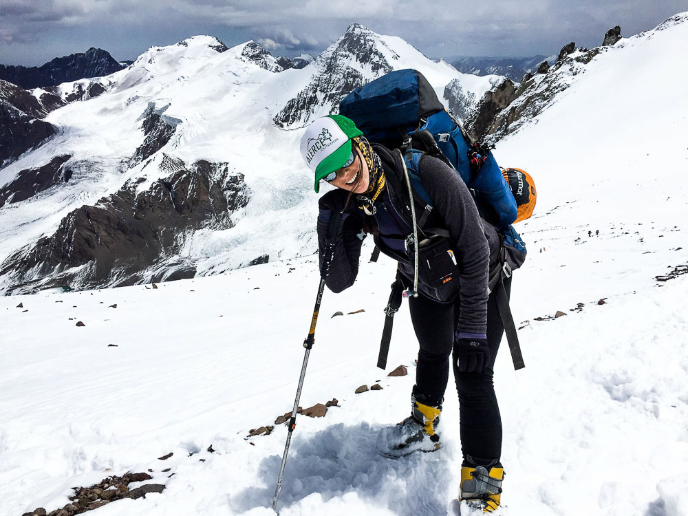
Here’s a view of the route to the summit, via the Normal Route from Base Camp, as seeen from Cerro Bonete.


Day 7 – Base Camp to Plaza Canada (porter) back to Base Camp
Climb: 4400m – 5000m – 4400m / 14400m – 16400ft – 14400ft
Distance: 4km / 2.5miles – link to wikiloc route
Depending on snow conditions and the weight of your backpack, portering can be a very helpful and necessary element. Carrying more than 20/25kilos at a crack (44/55lbs) is very hard, even though the distances are short between high camps. If you don’t do this, head out EARLY and take your time to rest along the way, to not fatigue your legs too much.
We divided our equipment and portered almost all the high camp gear to Canada, leaving just the tent, sleeping equipment, and food for the night, etc in Base Camp. We portered it to Camp 1 Canada and buried it under rocks, before heading back to Base Camp for the night.
Day 8 – Base Camp to Canada + portering to Nido de Condores
Climb: 4400m – 5500m – 5000m / 16400ft – 18000ft – 16400ft
Distance: 8km / 5miles – link to wikiloc route
Pack up camp in Base Camp and oficially head to Camp 1 Canada. Set up camp in Canada and then take the equipment that you portered the day before, up to Camp 2 Nido de Condores. Back down to Canada for sleeping.
Day 9 – Camp 1 Canada – Camp 2 Nido de Condores
Climb: 5000m – 5500m / 16400ft – 18000ft
Distance: 3km / 1.9miles
This day we head from Camp 1 (Canada) to Camp 2 (Nido de Condores), with all equiment that hasn’t been portered. Another night of white out snow for us left us with a pretty blanet of fresh powder, but that sure made for exhausting trailblazing.
GET MOUNTAIN GUIDE RECOMMENDATIONS
Send me a message and let me know what country you want to climb mountains in. I’ll send you contact information of certified guides I trust.

Day 10 – Camp 2 Nido de Condores – Camp 3 Colera
Climb: 5500m – 5970m / 18000ft – 19587ft
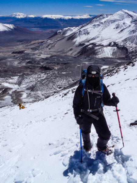
On our way to camp 2, Nido de Condores. Are we there yet?
Here, do another equipment check. If there’s anything you can leave in Nido de Conderes, do it. Consider portering equipment from Nido to Colera the day before, if you want to. Here, you must take additional food in the case of bad weather and you need to keep rainchecking the summit attempt. A good window is to progam up to 3 days of bad weather. So, instead of 1 days food, you need to take 4!!
Day 11 – Colera to Summit and back
Climb: 5970m – 6962m – 5970m / 19587ft – 22842ft – 19587ft
THE BIG DAY!!!!! It’s normal to leave camp around 4:30-5:30am, depending on wind. Summit takes from 7-10 hours on average. We took 9 hours, with significant snow and reasonable wind (30-40kph). Read this post for how the summit day worked out for us.
You first hit Piedras Blancas, then the Indpendencia Shelter, then the windy Portezuelo de Viento, then trudge up the shoot (canaleta), before finally hitting the cave to take a little rest and then pushing on for the last part, Filo de Guanaco, and then the big reward, the glorious summit!!




Day 12/13 – Summit Attempt 2/3 (bad weather days)
Stay at camp in Colera or head down more, whatever you need, eagerly watching the skies and waiting for Mother Nature to give you the window.
Day 14 – Camp 3 Colera to Basecamp
Descend: 5970m – 4400m / 19587ft – 14400ft
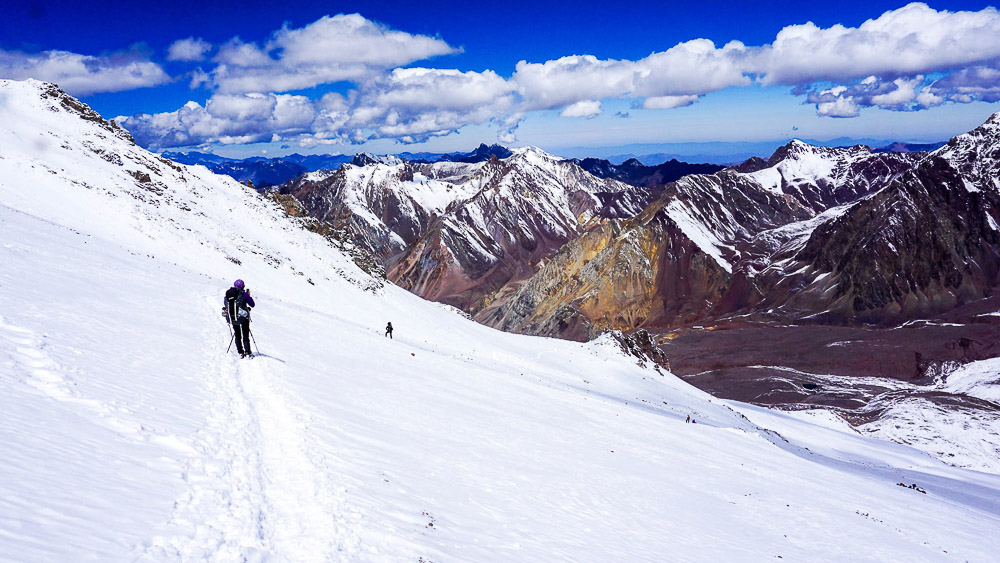
Camp Canada is right at the ledge.. and do you see base camp down below?
Hopefully with happy hearts and smiling souls, you head back to basecamp where we will you can buy a shower, a pizza, a massage, or whatever your happy mountaineering, summit seeking heart desires!!
Day 15 – Base Camp to Mendoza / Santiago
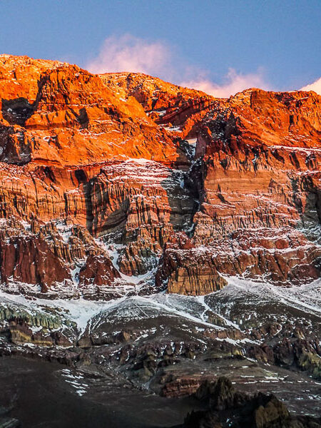
En route to Aconcagua, there are many diverse mountain formations and structures.
After a hearty breakfast and last a little reflection and loading the mules, start your 25km / 15.5mile trek out of the park.
Related Articles

I'M TALKIN' TO YOU
Purpose-driven people who feel compelled to make life meaningful for yourself and others.
Outdoor-inspired people whose best self comes alive when experiencing beautiful places and pushing your limits in the open air.


