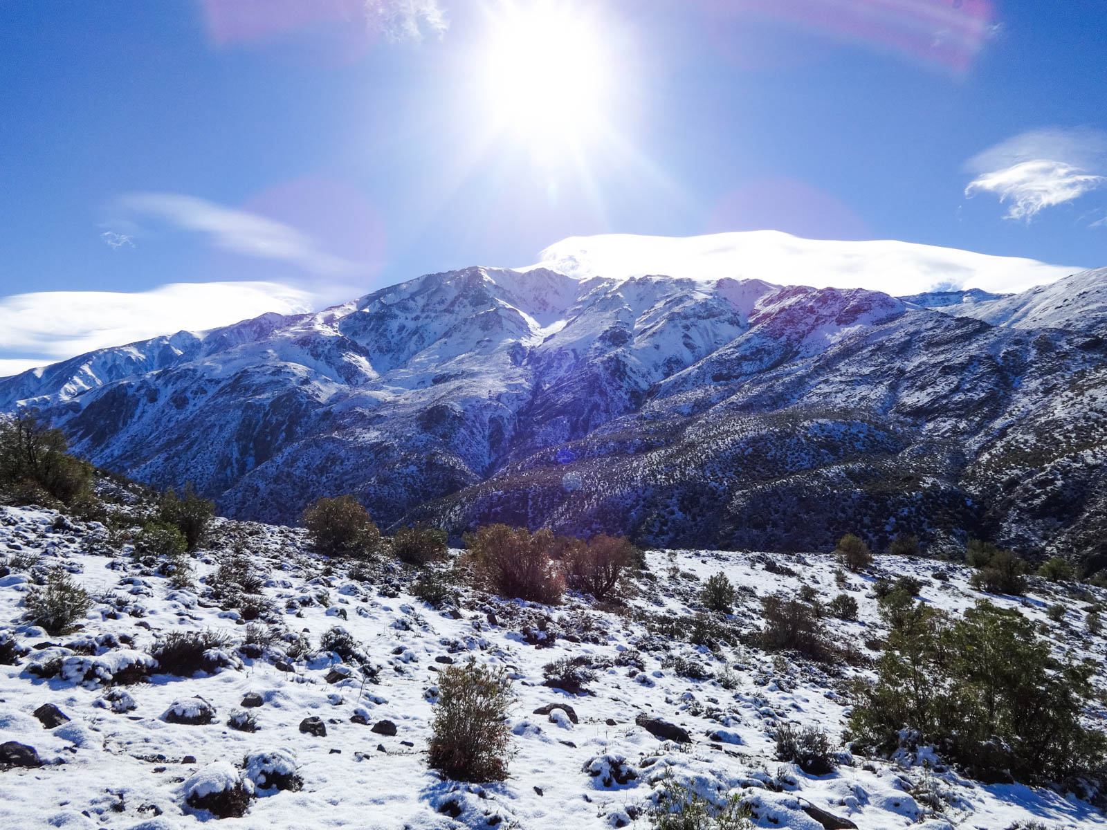
If you’re looking to do some trekking near Santiago, and want to avoid the typical Cerro Pochoco or Cerro Manquehue, look no further than Cerro Canoitas!! At an altitude of 2,650 meters (8,695 feet) you can climb up and down in 5-7 hours. It is pretty year round but especially gorgeous when there’s a layer of white powder covering it’s ground.
–
Cerro Canoitos is in Farellones, near Santiago’s best ski resorts, about an hour from the city. Considering it is not difficult and goes without even a momentary break in beauty, it is an ideal day trek near Santiago if you’re looking to do a little exercise or for an opportunity to breath some fresh air.
Many times, people get stuck going to Cerro Provincia, Cerro Pochoco and Cerro Manquehue because they don’t know of other places to go. Well, let me tell you, between Cajon del Maipo and Farellones there are so many options, there’s no need to get stuck in a traffic jam on the mountain!!
The ascent to the summit offers a couple shots overlooking Santiago, an impressive view of the Western mountain rage, and a look to the East even reveals Cerro el Plomo.
Cerro Canoitas in Stats
Altitude: 2,650 meters; 8,695 feet
Elevation gain: 1,000 meters; 3,280 feet
Distance: 10 kilometers; 6.2 miles
Time: 5-7 hours round trip
Difficulty: none
Nothing about Cerro Canoitas is hard, so it’s a perfect trekking option for people of all levels.


Hiking and trekking near Santiago
The Farellones area offers many options
I went during early winter, after a week of heavy rain, and the muddy trail and snowy surroundings were abolutely spectacular. The first part of the climb has a soft incline and clearly marked trail.
We passed a herd of cows grazing the landscape that was filled with bouts of snow-covered shrubbery and bushes. We also passed a man enjoying the solitude and crisp air, fully engulfed in his mummy sleeping bag and not fazed by the chilliness. Our day was simply gorgeous, clear blue skies and mild wind.
The middle part of the trek was mostly dirt and loose rocks, and, due to the recent rain, had transformed into a mudpit. Trying to not completely demolish my shoes, I tried to step from one snow dotted area to the next. The snow also helps a lot with footing in comparison to the mud-jelly.
About half way up we stopped at a beautiful scenic overview, perfect for snapping pics, having some water, and grabbing a quick bite. There was another group on the mountain that was sitting there having some beers. They weren’t heading to the top and their itinerary that day looked to be simply what they were doing in that moment – sitting there and chatting the day away. It looked 100% like something up my alley.
The top third gave us an abrupt change in weather, much windier and it got colder with every step. After a random sharp incline that tops off in a more horizontal section, you’ve got about five minutes left before touching the summit’s flag. Up on the top there was a significant bite in the air. It was definitely too cold to do the typical lunch-on-the-summit so we just hung out, took pictures, and took in the view for twenty-ish minutes before heading down to more friendly weather.
Free Tool: Give Notice Before An Outdoor Activity
Before going to the mountain, or doing any outdoor activity, it is important to give notice. This ensures that you can effectively and efficiently be found in case of an accident or emergency.
This tool lays out what critical information needs to be included and has a PDF you can easily fill out and send to your emergency contacts.

360 views, the best part of a summit!
One of the things I love about being on the top of a mountain is the 360 view, especially here in Chile where we have the shorter costal mountain range as well as the towering Andes. Standing in one spot and just shifting in a circle, the views change drastically.
One side completely white with slits of rock peeking through and the other full of rocky peaks. As cheesy as it sounds, standing there I can’t help but get filled with an appreciation for the miracle of life and the way this world just functions on its own.
All the elements working harmoniously together, us humans being only one small part in the bigger puzzle.
Going down was like a slip and slide. I was litterally skiing in my boots over the mud, with my only goal being not falling. We found the carcass of a poor cow who probably had wandered too high up on the mountain, gotten lost, and died from the cold.
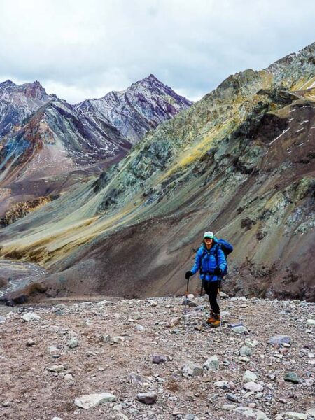
Almost all the way to the bottom, we followed the river a bit before veering over in direction of the road. I must say, I was utterly impressed with this entire trail, it provided a constant flow of the most striking color contrasts and panoramic landscape views.
It was the ideal day for trekking near Santiago!! Scraping as much of the mud off our boots as possible, we headed to a local pizza and artesanal beer restaurant to replenish some calories.

When can you hike Cerro Canoitas?
You can hike Cerro Canoitas all year round. It offers no tecnical difficulties and is a fantastic option for non-stop panormics and fun trekking near Santiago. While it offers some greenery during the summer, it doesn’t have much shade, so be prepared with lots of water if you’re climbing during the spring or summer. The beating sun can make the climb a bit unbearable.
Personally, I think Cerro Canoitas is a hidden gem when it’s covered with any layer of fresh powder. If you go during the middle of winter when there is lots of snow, take your snow shoes or randonee (cross country skies)!!
How do you get to Cerro Canoitas?
In a car, head towards Farellones and, right before the curve that goes to the ski resorts, take the road towards the Los Bronces mine. After 5ish kilometers, cross the bridge and soon you will see a place to leave your car. There is no public transporation to get to this mountain. The route to begin is right where you’ll park the vehicles.
Now, get out of Santiago and plan your next weekend trip to Cerro Canoitas!
Related Articles

I'M TALKIN' TO YOU
Purpose-driven people who feel compelled to make life meaningful for yourself and others.
Outdoor-inspired people whose best self comes alive when experiencing beautiful places and pushing your limits in the open air.


